Clouds are the atmosphere's storytelling medium. For pilots, they're not just scenery. They're weather briefings written across the sky. Learn to read them, and you'll understand turbulence, icing, and visibility long before your instruments confirm what the sky already told you.
The Basics: High, Middle, Low
Cloud classification starts with altitude. Cirrus clouds (the wispy, high-altitude ones) form above 20,000 feet and are made of ice crystals. They often signal an approaching warm front 12 to 24 hours out. Altostratus and altocumulus live in the middle layers, typically between 6,500 and 20,000 feet. Stratus and cumulus occupy the lower atmosphere.
For VFR pilots, the low clouds matter most. A solid stratus layer at 2,000 feet AGL means your planned cross-country just became an IFR flight, and if you're not rated, it became a no-go.
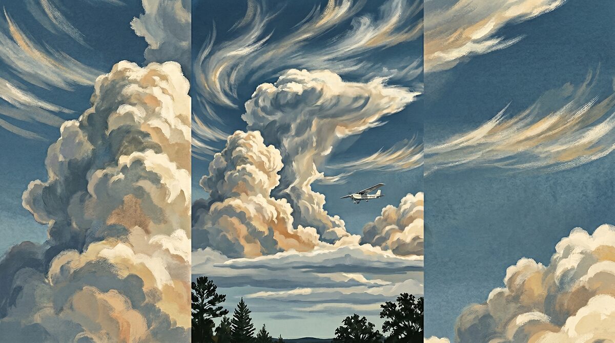
Cumulus: The Good and the Ugly
Fair-weather cumulus are a pilot's friend. They indicate thermal activity but generally benign conditions. Small, scattered puffballs with flat bottoms and rounded tops mean the atmosphere is doing its thing in a manageable way. You might get some light bumps flying through or near them, but nothing dramatic.
When those flat-bottomed cumulus start growing vertically, pay attention. Towering cumulus (TCU) are the precursor to cumulonimbus, the thunderstorm cloud. If you see vertical development reaching toward the upper atmosphere, you're watching a thunderstorm being born. Give it wide berth. The FAA recommends at least 20 nautical miles from any thunderstorm cell.
Lenticular Clouds: Mountain Wave Warning
If you fly anywhere near mountains, learn to recognize lenticular clouds. They look like smooth, lens-shaped formations that hover near ridgelines. They're beautiful. They're also a signpost for mountain wave turbulence that can exceed structural limits of light aircraft. Lenticulars mean strong winds aloft and rotors below. Respect them.
Fog: The Sneaky One
Fog is just a cloud at ground level, but it's responsible for more VFR-into-IMC accidents than any other weather phenomenon. Radiation fog forms on clear, calm nights and burns off after sunrise. Advection fog rolls in when warm, moist air moves over cooler ground. The key difference: radiation fog is predictable and temporary. Advection fog can persist for days.
Check your TAFs and METARs, but also look outside. If visibility is dropping and you can see moisture forming at the surface, it's time to land or divert. Now, not in 10 minutes.