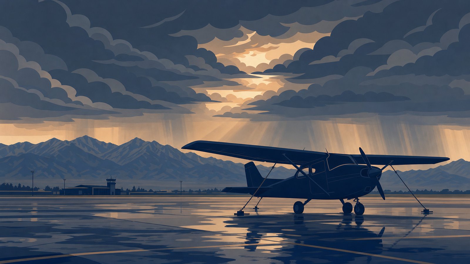
Friday was supposed to be a lesson. By Friday morning the ASOS readout was getting ugly, the PIREPs out of the Front Range were stacking up moderate turbulence and low-level wind shear, and the TAF was already showing increasing winds with rain. I sat with the briefing for another five minutes hoping the trend would soften. It didn't. So I cancelled. Again.
That was the fourth weather cancel in the last few weeks. I'm not the only one. On May 5 a rare late-season snowstorm dumped 5 to 8 inches on Denver. On May 21 the FAA issued a full ground stop at DEN when high winds chewed up the evening arrival flow. By the end of May, severe storms were marching across the Front Range and Central Plains almost every afternoon. If your logbook gained more rust than ink this past month, you have company.
Here's the part nobody likes hearing: the next six months are probably going to be worse before they get better. A developing El Niño is going to reshape the summer weather pattern across Colorado in ways that pile on more grounded days through fall. So let's talk about why this spring has been brutal, what El Niño actually is, what's coming, and what you can do with the days the sky takes from you. Because being stuck on the ramp is not the same as being stuck.
Why Colorado in Spring Is the Hardest Season to Be a Student Pilot
Spring and early summer on the Front Range are uniquely hostile to VFR training. It's not your imagination, and it's not your CFI scheduling poorly. It's the terrain meeting the season.
Upslope and lee waves. The Rockies are a giant terrain feature that turns ordinary synoptic systems into amplified local weather. When a low pressure system rolls across the plains and the wind goes easterly, you get upslope flow that piles moisture against the foothills and creates persistent low ceilings — sometimes for days. When the wind reverses and goes westerly, you get mountain wave activity, lee turbulence, and the kind of mechanical turbulence that ruins a pattern lap before you've even rolled out.
The afternoon convection cycle. From late April through September, the daily playbook on the Front Range is roughly: clear morning, building cumulus by 11 AM, towering cumulus and thunderstorms by 2 PM, severe potential by 4. By the time most of us can get to the airport after work, the airspace looks like a popcorn bag full of CBs. The morning is your friend. The afternoon is not.
Density altitude. KAPA sits at 5,883 ft MSL. On a 90-degree afternoon with low humidity, your density altitude is comfortably north of 8,500 ft. Your Cessna 172 isn't broken — it's just doing math you don't like. We've got a full post on density altitude in Colorado if you want the longer version.
The wind reality. The Front Range gets persistent 20 to 35 knot winds out of the south or west, often gusting into the 40s. The crosswind component for a runway like 17L at KAPA pegs the limit on a routine afternoon. If your personal minimum is 12 knots of crosswind, you're going to cancel a lot.
Now layer El Niño on top of that.
What El Niño Actually Is (And Why It Affects a Cessna at KAPA)
El Niño is part of a recurring climate pattern called the El Niño Southern Oscillation, or ENSO. The pattern lives in the equatorial Pacific Ocean and shows up as periodic warming or cooling of the central and eastern Pacific sea surface temperatures. When that ocean region runs warmer than normal — specifically a region called Niño 3.4 — it's an El Niño. When it runs cooler than normal, it's a La Niña. Neutral is in between.
That sounds like an oceanography problem, not a pilot problem. It isn't. The Pacific is the largest single piece of the Earth's climate machinery. When it warms up, the atmosphere above it warms up. That changes where convection forms in the tropics. That shifts the position and strength of the jet stream. The jet stream is the conveyor belt that drives weather systems across North America. Move the jet stream south, and storms ride a different highway. The result reaches all the way down to a 152 on a Tuesday morning in Castle Rock.
For Colorado specifically, an El Niño summer tends to mean a few things. First, a stronger southwest monsoon, because the warmer Pacific feeds more moisture into the desert southwest and Mexico, which then gets pulled north into Colorado and Wyoming. Second, more afternoon convection across the Front Range, because there's more available moisture to turn into thunderstorms when the heating cycle does its thing. Third, more variable transition weather in fall, when the jet stream is wobbling toward its winter position and the pattern can swing fast.
Where We Are Right Now and What's Coming
As of the week ending May 24, the Niño 3.4 index sits at +0.67°C, according to the Australian Bureau of Meteorology. That's still inside the ENSO-neutral band (−0.8°C to +0.8°C), but it's been climbing fast and the atmosphere is starting to respond.
The forecasting story is more interesting than the current state. The World Meteorological Organization's Global Seasonal Climate Update released May 21 projects a "rapid transition to a strong El Niño event" with multi-model ensemble means reaching approximately +1.8°C through the June–August season, and the WMO notes "very high forecast confidence" for that summer signal. The NWS Central Region Climate Outlook from May 24 gives an 82 percent probability that El Niño develops between May and July 2026.
NOAA's Climate Prediction Center has put the odds at 66 percent likelihood that this El Niño peaks at strong or very strong intensity, with a 96 percent likelihood it persists through winter. The CPC also raised the probability of a so-called "Super El Niño" — sea surface temperature anomalies greater than +2.0°C — to roughly 33 percent between November and January. That's up from 25 percent last month.
A note on the Super El Niño framing, because the headline-grabby version of this is everywhere right now. A 33 percent chance is real and worth paying attention to. It's also not a foregone conclusion. The honest read is: a strong El Niño is highly likely, a very strong or Super El Niño is possible but uncertain, and forecasters openly acknowledge the uncertainty in peak intensity. Plan accordingly. Don't panic accordingly.
For Colorado pilots specifically, the Colorado State University Climate Center is forecasting an active monsoon season and an above-normal precipitation tilt for the summer. Climate Prediction Center seasonal outlooks favor above-normal rainfall from June through September across most of Colorado, with the highest probabilities along the Western Slope and the Utah border. Translated to a Front Range cockpit, that probably looks like this:
- More afternoon convection days. Wetter monsoon means more moisture, which means more thunderstorm fuel during the daily heating cycle. Plan to fly early or not at all from late June into September.
- More LIFR mornings. Wetter pattern plus upslope flow events means more low-ceiling mornings. The "fly early" window may get squeezed from both sides.
- More days with embedded turbulence and LLWS. Active monsoon patterns aren't just a precipitation story. They drag in shear lines and outflow boundaries that turn calm air into chop fast.
- A stormy fall transition. El Niño is forecast to keep intensifying through the fall. Expect the pattern to stay active into October and beyond.
The good news, if you can call it that: a stronger El Niño typically suppresses Atlantic hurricane activity, which doesn't help Colorado directly but does mean fewer remnant-tropical-moisture systems sliding up from the Gulf in late summer. The other good news: an El Niño winter on the Front Range often runs above-normal precipitation in the southern half of the state, which is good for skiing and water tables. Just not for your logbook.
What to Actually Do When You're Grounded
This is the part of the post that matters. Because if El Niño is going to take a chunk of your training days through fall, the question becomes: how do you not lose ground? Here's what works for me. Most of it is free.
1. Debrief the lesson you almost flew
I built vCFI partly because I kept losing the texture of my flights between cancellation and the next reschedule. The Post-Flight Debrief module is built for exactly the moment you're sitting in your kitchen at 10 AM staring at the weather radar. Type up what your plan was, what your conditions were, what you would have done, and what your decision tree looked like. Get a structured walkthrough that ties back to FAR/AIM references and ACS-aligned technique. It's a study aid, not a replacement for your real CFI, but it's the closest thing to a free debrief you can run on a moment's notice.
For Friday's cancel I went through the whole go/no-go logic — ASOS trends, PIREPs of moderate turbulence and LLWS, the TAF picking up wind and precip — and got a clean writeup of the decision framework. That's a learning event, not a wasted day.
2. Practice the radio
The vCFI ATC Radio Simulator gives you five preset scenarios for KAPA (or any airport) — taxi for departure, closed-traffic taxi, takeoff, inbound for landing, flight following — plus a free-text Custom Transmission field. The AI controller responds with realistic phraseology, runway and taxiway assignments that make sense, and Suggested Actions that teach the right follow-up calls. If you're pre-solo and the radio still feels like swallowing a microphone, this is the single highest-leverage thing you can do on a grounded day. Do twenty minutes a day for a week and your next pattern lap will sound like a different pilot.
3. Plan a cross-country you can't fly
Open the vCFI Flight Planner, or open ForeFlight, or both. Build a real cross-country to somewhere you actually want to go — Laramie, Pueblo, Salida, Glenwood Springs. Do the weight and balance. Pull the METARs and TAFs. Look at terrain clearance. Calculate fuel burn and reserves. Look up the FBOs and field elevations. The point isn't to file. The point is to get the planning workflow into muscle memory before your CFI is sitting next to you with the meter running.
4. Read the same weather that grounded you
This is the most undervalued thing you can do as a student pilot, and the most expensive habit not to build. The weather that grounded you Friday is also weather you'll see again, repeatedly, for the rest of your flying career. Pull up the same Skew-T diagram you skipped past on the briefing. Read the area forecast discussion the NWS Boulder office issued that morning. Compare the TAF to what actually verified. Look at how the surface analysis evolved over the next 12 hours. Build the pattern library. That's the difference between a pilot who cancels and a pilot who knew an hour earlier they were going to cancel.
5. Catch up on the books you keep putting off
If you've never read the Pilot's Handbook of Aeronautical Knowledge from end to end, do it. If you have, do it again. Same for the Airplane Flying Handbook. Same for the relevant sections of FAR/AIM. The FAA hosts all of them free. They're more readable than people remember, especially when you're already in training and the references have context.
6. Knock out the written test prep
If the FAA written is still ahead of you, this is the day. King Schools, Sporty's, and Gleim all have solid programs. Grounded days are a gift to that part of your training. Stop pretending you'll do it on the weekend you fly.
7. Hangar time with your A&P
If you don't already know what a 100-hour inspection looks like, ask your local A&P if you can come watch one. Most will say yes. Watching what they actually find — chafing on a wire bundle, a frayed control cable, a magneto with a marginal timing — will permanently change how you preflight. It's one of the highest-leverage afternoons you can spend at the airport.
8. NTSB report binge
The NTSB aviation accident database is publicly searchable. Pick a category — VFR into IMC, density altitude, fuel exhaustion, controlled flight into terrain on takeoff — and read ten reports back to back. You'll never approach those situations the same way again. Sobering, useful, free.
9. FBO networking
Pilots talking weather at the FBO is the second-best classroom in aviation. The best is the cockpit, but the FBO is open on cancelled days. Show up. Listen. Ask questions. Don't try to sound smart. The local-knowledge layer for Front Range flying — which winds put you on the ground at which airports, which months are the worst at which fields, how the wave sets up over Pikes Peak on a Chinook day — is not in any handbook. It lives in the heads of the pilots already at your home field.
10. The gear list
Fix the headset. Replace the kneeboard. Clean out the flight bag. Buy the spare batteries you've been meaning to buy. Charge the iPad. Update ForeFlight. Pack the bag the way you'll actually use it. Future-you will appreciate it the next clear morning.
Personal Minimums for an El Niño Colorado Summer
If the forecast plays out anywhere close to what the models are projecting, this is a good time to sharpen your personal minimums rather than soften them. A few things to consider, written specifically for Front Range flying.
Lower your wind ceiling, especially gust factor. The published demonstrated crosswind for a 172 (15 knots) is not a personal minimum. If your normal personal max is 12 knots steady, consider tightening to 10 with gust factor below 5. Front Range summer gusts are vicious near the surface.
Tighten your time-of-day window. Push aside afternoon flights from late June through September. If the only time you can fly is afternoons, expect to cancel half of them. Either restructure your schedule or set a hard rule: no departures after 1 PM during monsoon months. Use the personal minimums framework if you haven't built one yet.
Density altitude floor. Pick a number and don't deviate. For me at KAPA in a 172, I've drawn a line at 8,500 ft DA for routine training departures. Above that, I'm flying lighter, earlier, or not at all. The Aircraft Flying Handbook is direct about this: high DA reduces every margin you have.
The PAVE checklist. Pilot, Aircraft, enVironment, External pressures. Run it every time, especially when you're trying to talk yourself into a marginal departure. The most common failure mode for student pilots in summer Colorado isn't the weather. It's the external pressure to fly anyway because the lesson is paid for and the CFI is on the schedule.
The Takeaway
Being grounded is the system working. A trip cancelled is better than an NTSB report. The four cancels I've had recently aren't lost lessons — they're decisions I made correctly with the information I had. Friday especially.
El Niño doesn't stop training. It changes when you train. The pilots who handle this summer well will be the ones who fly early, accept the cancels gracefully, and use the grounded days the way they were given. Come back sharper than when the weather pinned you down.
If you've got specific stories about getting grounded this spring, what worked for you, or what you wish you'd done with the cancelled days, I'd love to hear them. Hit the contact page or email me at the address there. The community part of this gets better when more pilots share notes.
Now go look at the weather. If you're flying tomorrow, you've got planning to do. If you're not, you've got reading to do.